An official website of the United States government
Official websites use .gov A .gov website belongs to an official government organization in the United States.
Secure .gov websites use HTTPS A lock ? or https:// means you’ve safely connected to the .gov website. Share sensitive information only on official, secure websites..
CoastWatch researchers recently collaborated with scientists in Massachusetts to study the feasibility of using satellite data to monitor water clarity in Cape Cod.
The NOAA Advanced Clear-Sky Processor for Ocean (ACSPO) L3S-LEO-PM and L3S-LEO-DY products will be updated from ACSPO v2.80 to ACSPO v2.81 on October 2, 2023.
The Joint Polar Satellite System (JPSS) has approved NOAA-21 Visible Infrared Imaging Radiometer Suite (VIIRS) Advanced Clear Sky Processor for Ocean (ACSPO) sea surface temperature (SST) products for Provisional Maturity
A Frequently Asked Questions (FAQs) for Sargassum was composed by the NOAA Atlantic Oceanographic & Meteorological Laboratory (AOML) in partnership with NOAA CoastWatch Caribbean, Gulf of America, and Atlantic OceanWatch Node.
The West Coast Node (WCN) of CoastWatch is home to thousands of datasets; from ACSPO SST to Vector Winds, their ERDDAP server stores decades of historic climate data. But one group of products stands out with its impact on the coastal communities of California and Southern Oregon: C-HARM.
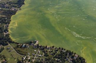
NOAA's National Ocean Service uses CoastWatch ocean color data along with cell counts and other environmental information to produce a Harmful Algal Blooms Observing System (HABSOS) and a Harmful Algal Bloom Operational Forecast System (HAB-OFS).
In collaboration with the NOAA Atlantic Oceanographic and Meteorological Laboratory's Ocean Chemistry and Ecosystems Division and NOAA Coral Reef Watch, the Caribbean/Gulf of America node of CoastWatch produces an ocean acidification product suite for the greater Caribbean region to track changes in the surface ocean that can be used as an important tool in coral reef research and management.
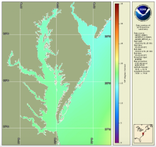
The National Estuary Program identifies, protects, and conserves water quality for ecologically significant estuaries and surrounding watersheds. The National Estuary Program uses Sea Surface Temperature time series products produced by the NOAA CoastWatch East Coast Node for estuary management.
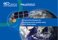
AquaWatch, the Group on Earth Observations (GEO) Water Quality Initiative, presents information about water quality issues and monitoring in a variety of habitats and exemplars of water quality monitoring using archived and next generation Earth Observation data using technologies developed and exploited by researchers within the AquaWatch community.
In a paper published in 2017 in Progress in Oceanography, coauthors Guanming Zheng and Paul M. DiGiacomo reviewed approaches to deriving water quality products from satellite ocean color data. They quantify and discuss the inherent uncertainties surrounding the characterization of water quality parameters of interest in coastal waters


![Scientific Figure showing contributions of phytoplankton(link is external), CDOM, and nonalgal particulate(link is external) absorption coefficients(link is external) to total non-water absorption for waters with relatively (a) higher and (b) lower degrees of correlation between [Chl-a] and Rrs(490)/Rrs(555)](../sites/default/files/styles/medium/public/2022-12/1-s2.0-S0079661116302592-gr13f81d.jpg?itok=rBw8w8QW)