ACSPO

Description

 Advanced Clear Sky Processor for Ocean (ACSPO) is the NOAA Enterprise SST system

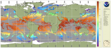
ACSPO Global SST from VIIRS

Product Families
Sea Surface Temperature
Summary

These VIIRS SST data are produced using the NOAA Advanced Clear-Sky Processor for Ocean (ACSPO) SST system, from the afternoon NPP, N20 and N21 satellites, in two formats: L2P and L3U (uncollated). The data are reported in 10 min granule files in NetCDF4 format, compliant with the GHRSST Data Specifications v2 (GDS2). For each satellite, there are 144 granules per 24 hr interval, with a total data volume of ~7.1 GB/day for L2P, and ~0.4 GB/day for L3U.

ACSPO Global SST from MODIS

Product Families
Sea Surface Temperature
Summary

The ACSPO MODIS SST data are produced from Terra and Aqua satellites using the NOAA Advanced Clear-Sky Processor for Ocean (ACSPO) enterprise system (Ignatov et al., 2016). Complete archive of ACSPO MODIS SST data is available for both the Terra (24 Feb 2000 - present) and Aqua (4 July 2002 - present) missions in 0.02° L3C (level 3 collated) format. New data is added in delayed mode (DM) with a 2-month latency.  The last orbital maintenance maneuvers for Aqua and Terra were performed on 27 Feb 2020 (Terra) and 18 Mar 2021 (Aqua) and their orbit has been drifting ever since. We do not recommend usage of ACSPO MODIS SST dated a year or later after each satellites' last orbital maintenance maneuver. For more recent SST data from low earth orbit satellites, we recommend the ACSPO VIIRS and AVHRR FRAC datasets.

ACSPO Global SST from AVHRR GAC

Product Families
Sea Surface Temperature
Summary

AVHRR GAC Reanalysis 2 (RAN2) dataset is an improved and extended version of AVHRR GAC RAN1 (Ignatov et al., 2016). RAN2 is produced from 5 AVHRR/2s (onboard N07/09/11/12/14) and 5 AVHRR/3s (N15/16/17/18/19) using the NOAA Advanced Clear-Sky Processor for Ocean (ACSPO) enterprise system v2.81. At the time of release, it covers from 1 Sep 1981 to 31 Dec 2021 and will be periodically extended as new L1b data from N15/18/19 arrive. Out of ten satellites, seven (N07/09/11/14/16/18/19) were initially launched into afternoon orbits (1:30pm/am), two (N12/15) into early-morning orbits (7:30pm/am), and one (N17) into mid-morning orbit (10am/pm). All NOAA orbits are not controlled and evolve in time. The RAN2 dataset is documented in (Petrenko et al. 2020 and 2021; Pryamitsyn et al. 2020)

ACSPO Global SST from AVHRR FRAC

Product Families
Sea Surface Temperature
Summary

The AVHRR FRAC SST data are produced from AVHRR/3s onboard Metop-A, -B and -C satellites using the NOAA Advanced Clear-Sky Processor for Ocean (ACSPO) v2.80 enterprise system, described in (Ignatov et al., 2016). Currently, near-real time (NRT) L2P and  0.02° L3U (gridded uncollated) data for Metop-A, -B and -C is produced at STAR (with ~2 to 6hrs latency). The data are being archived at PO.DAAC, and also available at this CoastWatch page as a 2 weeks rotated buffer. Metop-A mission officially ended at 2021-11-15 and the production of the ACSPO SST for the Metop-A ended at 2021-11-14 due to data degradation on 2021-11-15. 

ACSPO Global SST from AHI

Product Families
Sea Surface Temperature
Summary

The AHI SST data are produced from Himawari-9 (Himawari-8 before 2022-Dec-13) geostationary satellite using the NOAA Advanced Clear-Sky Processor for Ocean (ACSPO) v2.90 enterprise system,(ACSPO v2.70 was used for Himawari-8). Currently, only near-real time (NRT) data are produced at STAR, with a 2-6 hour latency (typically closer to 2 hours). The data are available in NetCDF4 format, compliant with the GHRSST Data Specifications v2 (GDS2). The data for Himawari-8 was archived with PO.DAAC with start date 2019-Oct-16 and end date 2022-Dec-13. The full mission of the Himawari-9 has been archiving in PO.DAAC. The data for Himawari-9 is also available at this Coast Watch page as a 2week rotated buffer.  The reanalysis of the full mission of the Himawari-8 is available at this Coast Watch page. There is a plan to reprocess the AHI data, for the full Himawari-9 missions.

ACSPO Global SST from ABI

Product Families
Sea Surface Temperature
Summary

The ABI SST data are produced from GOES-East (GOES-16) and GOES-West (at present GOES-18, before 2023/01/10 GOES-17) satellite using the NOAA Advanced Clear-Sky Processor for Ocean (ACSPO) v2.xx enterprise system. Currently, near-real time (NRT) data are produced at STAR, with a ~2-6 hour latency. A Reanalysis (RAN) dataset for GOES-16 is also available. The data are available in NetCDF4 format, compliant with the GHRSST Data Specifications v2 (GDS2). Currently, the data are archived on PO.DAAC and available at this Coast Watch page as a 2week rotated buffer.

NOAA CoastWatch co-gridded VIIRS SST from ACSPO

Product Families
Sea Surface Temperature
Summary

NOAA CoastWatch co-gridded VIIRS SST products are Level 3 daily composites in compatible format and projection with other CoastWatch Level 3 sector and global products (such as CoastWatch sector VIIRS ocean color).  Twenty four CoastWatch sector files mapped to equatorial projection that cover the globe (see Description tab for sector definitions) two polar stereographic sectors in 750 m nominal, native resolution and a global, 4 km resolution, single file mapped product is also available. These CoastWatch Level 3 products are generated from ACSPO L2P SST as input.

ACSPO Global 0.02º Gridded Super-collated SST and Thermal Fronts from Low-Earth-Orbiting Platforms (L3S-LEO)

Product Families
Sea Surface Temperature
Summary

NOAA Advanced Clear-Sky Processor for Ocean (ACSPO) L3S-LEO SST is a family of multisensor gridded ("L3") 0.02º resolution super-collated ("S") products. The L3S-LEO family is organized into three lines: PM, AM and Daily. The AM and PM lines correspond to 9:30am/pm and 1:30am/pm equator crossing times, respectively. The Daily line combines PM and AM (day and night) SSTs into a single daily L3S SST that is normalized to 1:30am viewing conditions.